Dave Hurd's ArcGIS 9.2 Techniques
Hillshading Gap Removal
The Remedy:
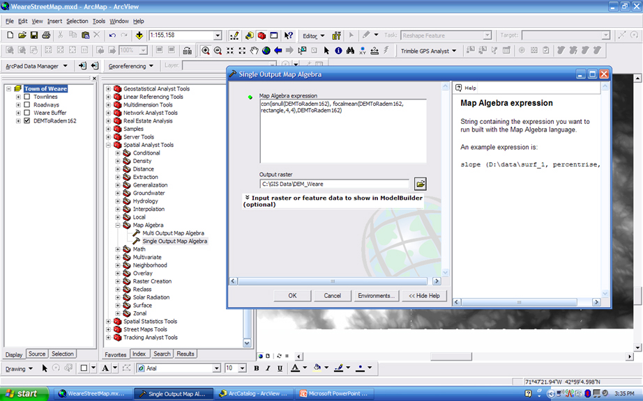
Applying a Map Algebra expression from the Single Output Map Algebra tool of the Map Algebra Toolbox under the Spatial Analyst Tools fixes the gaps composed of "nodata" between the spatial extents of the imported DEMs. Obviously, the Spatial Analyst license is required in order to perform this.
The expression used in this instance is:
con(snull(DEMToRadem162), focalmean(DEMToRadem162, rectangle,4,4),DEMToRadem162)where DEMToRadem162 is the name of my layer that contains the mosaicked DEM raster. DEM_Weare is the name I have chosen to contain the results of this gap cleanup.
Previous Page
- Page 3 -
Next Page
When not working as Sr CADD Technician / GIS Specialist, Dave can be found, gathering mapping data of any sort with his Trimble Recon and Trimble ProXT GPS Receiver, in order to have something new to work with in ESRI ArcGIS 9.2 and Trimble GPS Analyst. He is a big fan of ESRI and Trimble Navigation products.